What should a route map for an individual bus line show? When you’re at a bus stop deciding whether this is the bus you need, or when you’re on board deciding where to get off, what do you need to know?
Most of the world’s transit agencies have converged on a basic model. A single straight line, branching if the two directions diverge, with each station represented by its name alongside a dot or tick. Details of transfers will usually be shown, though in bigger cities this might be restricted to metro and heavy rail, since there will be too many bus connections to show on a readable diagram. Sometimes, information about local attractions, or facilities such as hospitals and tourist information centres, might be included.
What most route maps won’t show is the local street network. There are two reasons for this. The first is that this would render an otherwise simple diagram much more complicated. The second is that few routes are perfectly straight. The process of straightening a route out for a practical diagram while also showing the adjacent streets is far from trivial.
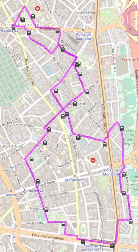
It seems that Paris’s RATP has decided it’s worth the challenge. Many of its hundreds of bus routes have route maps that look, at first glance, like a slice of a street map. These feature local streets along with landmarks like historic buildings, hospitals and universities. It’s only when you look closely that you’ll spot the level of geographical distortion at play to make this work.
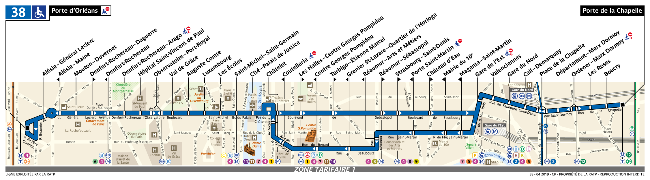
Take line 38. This is one of Paris’s straighter routes, running from Porte d’Orléans in the south to Porte de la Chapelle in the north. But it’s not quite as straight as it appears on the route map. Other changes have been made, too. Many of the smaller streets have disappeared: see for example the Île de la Cité, which in reality has a lot more than two streets. And many others have been rearranged. For example, the rue de Turbigo is dead straight in reality, but bends twice on the route map. The rue du Grenier Saint-Lazare, which should be perpendicular to the axis of the bus route, is twisted through 40 degrees to make room for the southbound bus stops, two streets over from the northbound route.
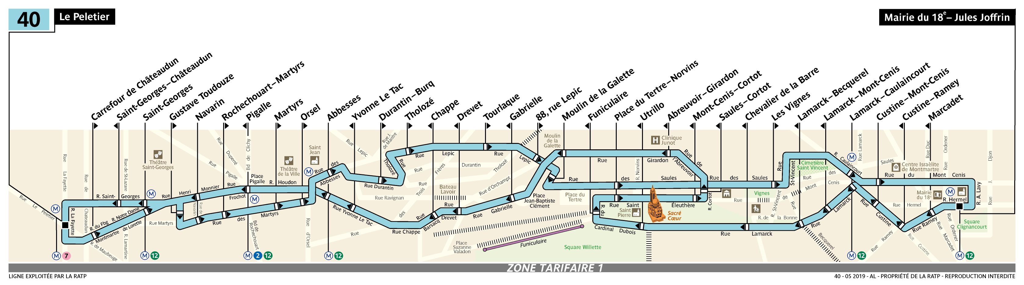
On the other end of the spectrum is line 40, whose small buses meander along the narrow streets of Montmartre. The route map for this line is a chaotic mess. Try finding your next station here.
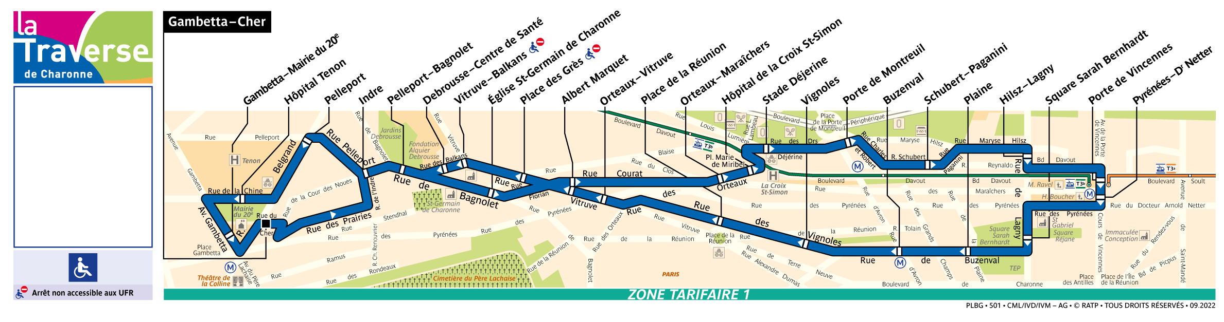
Or consider the La Traverse minibus lines, which operate circular routes in some of Paris’s outer neighbourhoods. A circular route doesn’t lend itself to this style. Firstly, the distortions required to make the streets fit in a small rectangle remove much of the benefit of showing them at all. Secondly, when almost all of the stations are one-way, it’s confusing to list them all at the top.
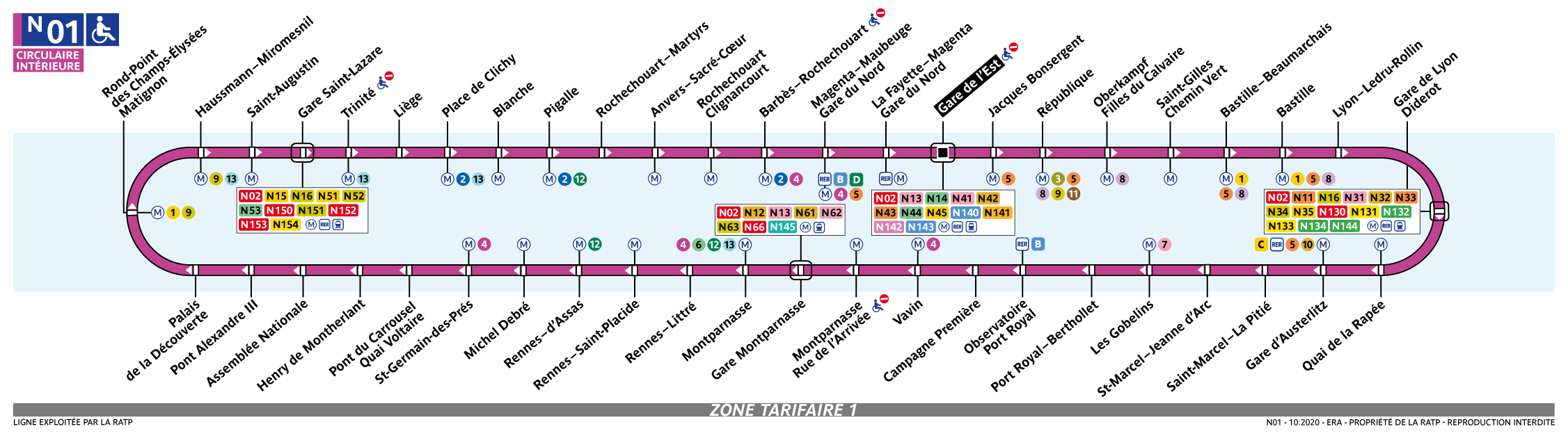
But the RATP knows how to do this. Look at its map for the circular N01 night bus route. The key details – stop names and connections – are displayed, without superfluous information. The map avoids the confusion of one-way stops by placing the names both above and below the circle. Daytime maps could be enhanced with information about places of interest by each stop. These would be supplemented by local area maps at the bus stops themselves, without any distortions or missing streets. Most stops already have these.
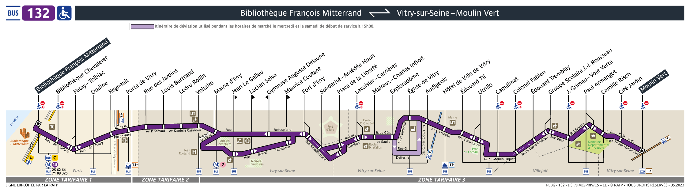
For suburban routes, the RATP sticks to the approach it uses for city-centre buses, but with less detailed street maps. Take the 132, whose map keeps only a few streets and sites of interest…
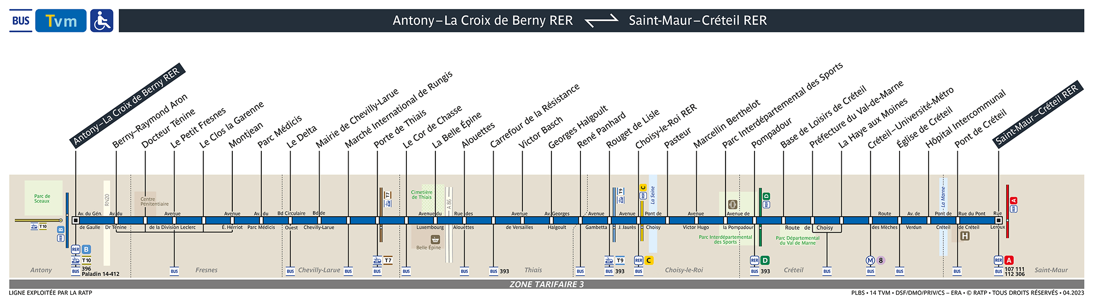
…or the Tvm, a Bus Rapid Transit line in the southern suburbs, whose map does away with any pretence of geographical accuracy by representing it as a perfectly straight line. As a special line, it doesn’t feature any one-way stations, making the way it lists the station names perfectly intuitive. It’s hard to fault this map. The features which have been kept – major roads, tramways, railways and the Seine – are genuinely useful.
In all, I have mixed feelings about these maps. I imagine a lot of time went into determining which streets to show, which to leave out, and how exactly to reshape them to make them fit. They’re certainly an interesting curiosity. But for wayfinding, I think the agency should have stuck with the tried and tested approach taken by other systems – and by the RATP themselves on the metro, tramways and even night buses – of a schematic map. And with the prevalence of one-way systems in Paris, serious work could be done to improve the readability of the station names.
A big shakeup is coming for Paris’s bus network. Privatisation is already underway in the suburbs, and is set to come to the city proper in 2026. For the moment, it seems that each operator handles its own maps. If transport authority Île-de-France Mobilités isn’t already at work developing a uniform approach to the subject, it will need to start soon.