Over the past few issues, we’ve been looking at transport projects in the Paris region that have never materialised. So far we’ve been focused on futuristic rail projects: the Aérotrain hovertrain, the Aramis personal rapid transit system, and the SK people mover. For today’s article, we’re looking at a technology that’s much more mundane, but at least as disruptive: the motorway.
In recent years, in the face of the twin crises of global warming and air pollution, municipalities across the world, and especially in Europe, have taken steps to reduce the place of the private car. Taking inspiration from cities to the north (like Copenhagen and Amsterdam) and south (like Madrid and Barcelona), Paris has made big strides in this direction. But things were different in the mid-20th century, when the private car was seen not as dirty, dangerous and damaging to the environment, but as a great liberator.
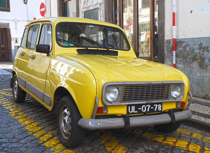
As western Europe got back on its feet after the Second World War and entered what the French call the Trente Glorieuses – thirty glorious years of economic growth and important improvements in living standards – the motorcar became affordable for working-class French families. Iconic models like the Citroën 2CV and the Renault 4 combined with a prolonged period of low oil prices to make driving accessible to an ever-growing number of people.
Accompanying the boom in car ownership was an inevitable surge in roadbuilding. During the postwar period, many of France’s arterial autoroutes were built or planned, mostly linking Paris to major provincial cities. At the same time, urban transportation policy was becoming more car-focused. This had begun before the war, with most of the Paris region’s tramways ripped up in the 1930s, but continued in earnest in the 50s and 60s.
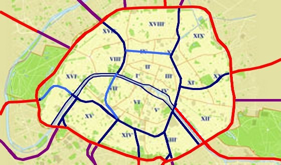
The boulevard périphérique, first touted in the 1940s, was opened in stages from 1966 to 1973. In 1967, the Voie Georges-Pompidou, a one-way motorway on the right bank of the Seine, was inaugurated. Shortly thereafter, the Voie Express Rive Gauche, its westbound counterpart on a section of the left bank, was completed. But these were just the start of a much more comprehensive plan, for a wholesale takeover of the city centre with controlled-access highways.
Plan autoroutier pour Paris
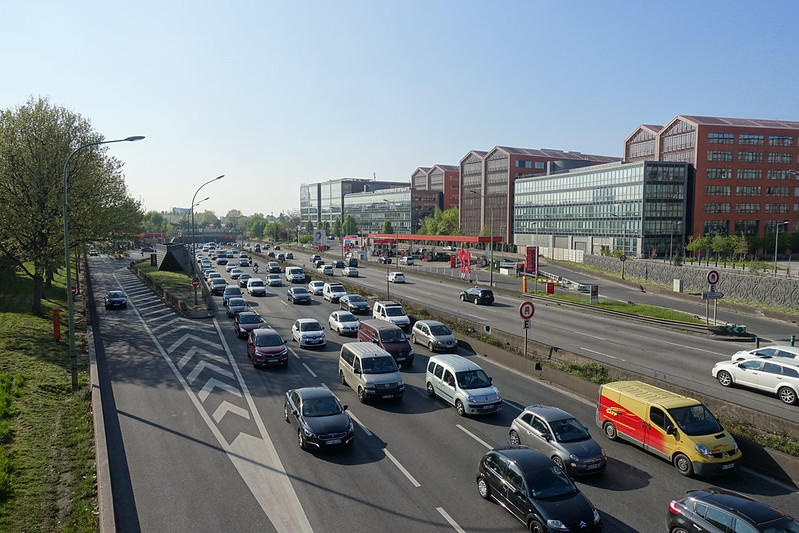
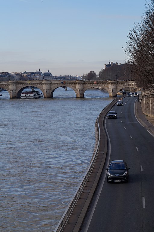
As it stands, the périphérique is already very central for such a major motorway: it forms a circle about half the diameter of that formed by London’s North and South Circular roads. With 4 lanes in each direction for most of its length, its throughput is also considerably higher: it’s one of Europe’s busiest urban motorways. And until its pedestrianisation in 2016, the Voie Georges-Pompidou brought traffic right into the heart of the city, metres away from the historic Île de la Cité.
But the Voie Georges-Pompidou was never intended to be unique. For a start, the Voie Express Rive Gauche (which only ever reached a length of 2.5 km) was meant to run along the entire left bank. But the plan devised in the 1960s, known simply as the “plan autoroutier pour Paris” (“motorway plan for Paris”), went much further than that.
Central to the plan was a north-south axis from the Porte d’Aubervilliers to the Porte d’Italie. This road would have filled in the Canal Saint-Martin, carrying 4 or 5 lanes in each direction. It would allow traffic from the north to flow towards the south of France without having to use the périphérique, and without encountering a single at-grade intersection.
In its central section, the axe Nord-Sud would form the eastern part of an inner ring road, together with a road along the southern boulevards that once formed part of the wall of the Farmers-General; a largely underground road linking Montparnasse and Saint-Lazare; and a deep bored tunnel completing the circle at the Gare de l’Est.
Many of the motorways that now terminate at the périphérique (A3, A6a, A6b, A13) were due to be extended beyond it to join this new orbital, along with others that, in the event, never made it to the edge of Paris (A10, A15, A16). Since these were intended to be bona fide motorways, all junctions would be grade-separated. The project would have seen the complete transformation of squares like the Place de la Bastille, the Place de la Bataille-de-Stalingrad and the Place d’Italie, and the construction of numerous other new interchanges, some of them underground, to connect the new roads with each other and with local streets.
Unsurprisingly given the density of Paris, the project would have been incredibly destructive. To make way for a bridge in the west, the rather magnificent Pont Rouelle would have been demolished (at the time, this bridge wasn’t in use, but today it carries the RER C). In preparation for the radiale Vercingétorix – connecting Montparnasse and the new ring road with the A10 from Bordeaux – buildings along the rue Vercingétorix actually were bulldozed, while an engineering school just outside the city was moved to the distant suburb of Gif-sur-Yvette to make way for the extended autoroute.
But the bulk of the planned destruction was in the east of the city. In the affluent 7th and 16th arrondissements in the west, much of the planned development was underground. But in the less well-to-do eastern half of the city, the axe Nord-Sud would not only have deprived locals of the Canal Saint-Martin, but also destroyed thousands of homes. The radiale de Bagnolet, which would connect the north-south road with the A3 to serve the eastern suburbs, was even worse: rather than following any existing routes, it was just supposed to smash its way through the homes and shops of the 11th and 20th arrondissements.
What went wrong?
When looking at a project as dystopian as this, it might be more pertinent to ask how it was allowed to get as far as it did.
The idea behind the project was to allow traffic to move quickly and smoothly through the city. But more likely than not, the roads would soon have been as clogged up as the boulevard périphérique (which has a speed limit of 70 km/h but sees average speeds of less than 40). Planners today see traffic as behaving more like a gas than a liquid: thanks to induced demand, it will expand to fill the space it is given.
All those extra petrol and diesel fumes in the city centre would have been terrible for the air Parisians breathe. No amount of sound protection would have blocked out all the extra noise from the roads’ cars, which unlike passenger trains would run all night. And since most of the new highways were expected to run on the surface, acres of land would have been cleared for them, destroying homes, greenery, and space for pedestrians and cyclists to move around.
Another big problem with at-grade motorways, in common with railways, is that they cleave communities in two. In the United States, they often play the role of walls of racial segregation. In Paris, some of the poorest neighbourhoods suffer from these barriers – La Chapelle is sandwiched between two heavy rail lines, while many areas on the edge of the city are cut off by the périphérique on one side and the boulevards des Maréchaux (not a motorway, but wide, busy and hard to cross) on the other.
So how did this project get so far? We’ve already mentioned the prevailing ideology of the day, which was certainly a good deal more pro-car than today. But even in the 1960s, most locals hated this plan – not just the people who were destined to lose their homes, but all those who knew the roads would diminish their quality of life. Indeed, the municipal council voted unanimously against it in January 1966.
_(1969)_-_53Fi5587.jpg)
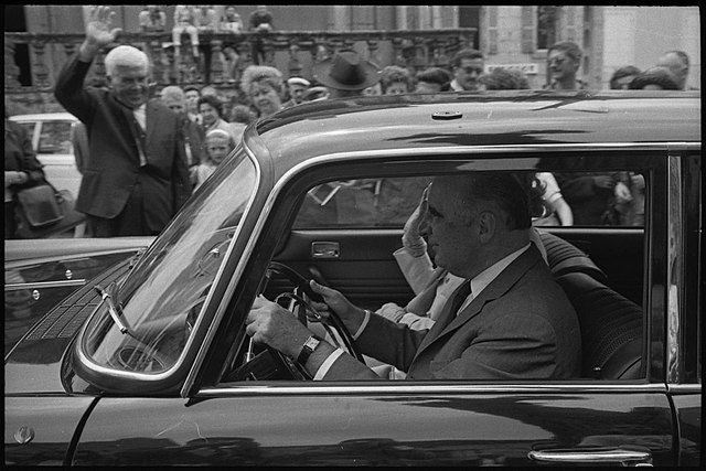
The trouble is, there was something of a democratic deficit in the Paris of the time. For most of the city’s post-Revolution history, it had been the only commune in France without a mayor: most policy was dictated to it from the central government. A mayor, it was thought, would hold too much power and threaten the stability of the Republic. And in the corridors of national power, cars were the future. Georges Pompidou, prime minister in the 1960s and president in the early 1970s, is remembered for his association with the politics of tout-voiture: dependence on the car at all costs. “We must adapt Paris both to the lives of Parisians and to the needs of the automobile”, he said in a speech of 1971; in light of his pursuit of car-friendly policies, this has been remembered by many as “we must adapt Paris to the car”.
I’d like to think the failure of this nightmarish vision of Paris was inevitable, but a look around the world makes me question that assumption. Across the Atlantic, sprawling cities like Houston and Los Angeles have until very recently oriented themselves almost entirely around the private car. Looking east, many of the hutongs of Beijing have been bulldozed to make way for wide, congested boulevards, a pattern replicated in cities across China. So what stopped Paris from going the same way?
Perfect timing
As the 1960s gave way to the 1970s, the political and economic landscape was moving gradually but decisively away from policies like this.
One blow came in May 1968, when a wave of student protests triggered a nationwide general strike and fears of a revolution. The protests had their roots in anticapitalism, but served as a catalyst for a number of other movements, including calls for nuclear disarmament, sexual liberation and, notably for our story, environmentalism. In this context, the new roads looked increasingly politically untenable.
By the late 1960s, grand urban redevelopment schemes of the type that destroyed historic neighbourhoods and replaced them with concrete were met with increasing hostility by the citizens of France. In this context, a national urbanism law in 1967 created a wealth of new rights and responsibilities for local governments. In particular, it allowed them to set up new urban planning agencies. The municipal council of Paris created Apur. One of this new body’s early dossiers concerned the proposed north-south axis. In a report of 1971, they questioned its effectiveness for transportation and concluded that it would quickly reach capacity, while reducing quality of life through air and noise pollution, the removal of trees and the creation of a new barrier. On 15 December of that year, the project was scrapped.
The next roadblock came in October 1973, in the shape of an oil crisis that would come to be associated with the end of the Trente Glorieuses, for its profound effect on the global economy. The oil price increase – fourfold in less than six months – significantly impacted car sales and prompted calls to encourage other modes of transport. This crisis would also be blamed for the abandonment of Aérotrain.
In April 1974, Georges Pompidou, aged 62 and still in office, died of a rare type of cancer. The subsequent president, Valéry Giscard d’Estaing, was less of an autophile than his predecessor, and more concerned with preserving the city’s heritage. His accession put the majority of the projects to bed.
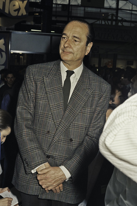
A question mark continued to hang over the extension of the A10 from the southern suburbs to Montparnasse. Work on this had already begun, but stalled in 1972 in the face of strong local opposition. The definitive end of the proposal came in 1977, thanks to the creation of the role of mayor of Paris and the election of Jacques Chirac, who would remain at the Hôtel de Ville until his move to the Élysée in 1995. One of his first tasks was to sign this project’s death warrant.
What remains of the plan?
Today, the banks of the Seine in central Paris have been given back to pedestrians. While the political right was opposed to their closure to traffic, no major mayoral candidate in this year’s municipal elections has proposed converting them back. East of the bassin de l’Arsenal, however, a two-way trunk road remains, extending the A4 to the edge of the 4th arrondissement.
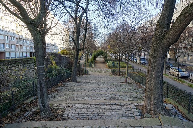
Few traces remain of the rest of the plan. Where buildings were cleared along the rue Vercingétorix, a series of public gardens have been installed. Elsewhere, the only testament to the roads is their absence.
The site of an old military hospital near the Gare de l’Est was meant to be used as a tunnel portal and interchange, but thanks to the project’s cancellation it instead became a park: the Jardin Villemin. The various roundabouts that were once destined to turn into vast motorway junctions, like the Place de la Bastille and the Place d’Italie, are instead transitioning in the opposite direction, with a reduction in traffic lanes.
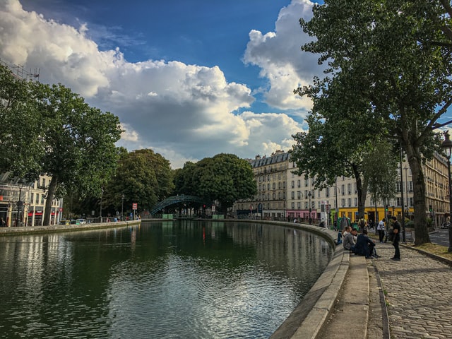
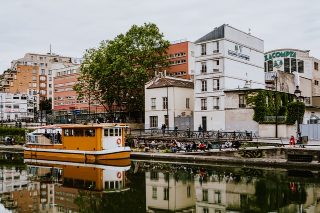
In the 1960s, it probably didn’t look like a bad idea to destroy the Canal Saint-Martin, which had seen its traffic dwindle almost to zero and the factories and warehouses lining it close down. But today it’s become a vibrant place, with tourist cruises on the water and groups of picnickers on the banks in the summer evenings. In another sign of how far policy has moved since then, the roads lining the canal on either side are closed to motor traffic on Sundays and public holidays, as part of Paris Respire.
The future
The movement against private cars continues apace, with the conversion of traffic lanes into bus and cycle lanes, the reorganisation of major junctions and even the proposed redevelopment of the boulevard périphérique as a more typical urban boulevard. This task would be immeasurably harder had the plan autoroutier gone ahead. But thanks to the helping hands of public opposition, a growing awareness of the dangers of car reliance, and the timely intervention of a global political crisis, Paris was saved from the chokehold of inner urban freeways.
This article is part of a series about the transport that never was in Paris: see below for links to the rest of the series. And as Paris continues its urban transformation away from car dominance, you can expect a lot more posts like this in the future. Be sure to subscribe to email updates below.